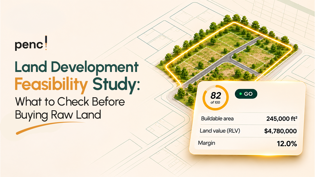
Raw land can look like a strong investment until development constraints start changing the numbers. Zoning restrictions, floodplains, drainage requirements, and infrastructure expenses can reduce its development potential. For land acquisition directors, developers, and homebuilders, the challenge is determining what the property can realistically support before committing capital.
A land development feasibility study turns preliminary assumptions into a structured evaluation of a property’s development potential and financial viability. It connects site constraints, estimated lot yield, development costs, projected revenue, and the maximum supportable land price.
This process is particularly important in expanding markets such as Dallas-Fort Worth, Austin, San Antonio, Charlotte, Raleigh-Durham, and Charleston. Each market presents different site conditions, infrastructure requirements, and approval considerations. The goal is to assess whether a property deserves further due diligence, requires a lower offer, or should be rejected.
What Is a Land Development Feasibility Study?
A land development feasibility study evaluates whether a parcel can support a proposed development and generate an acceptable financial return. It combines preliminary site analysis with financial underwriting to answer three fundamental questions:
- Can the property support the intended development?
- What will it cost to make the site development-ready?
- Does the expected revenue justify the land price and total project investment?
A typical study examines property boundaries, zoning, environmental constraints, buildable acreage, infrastructure requirements, financing assumptions, and projected revenue. For residential subdivisions, it also estimates how many saleable lots the property may accommodate. For multifamily and build-to-rent (BTR) projects, the analysis may focus on permitted density, unit count, development costs, and expected rental income.
The study should distinguish preliminary screening from final due diligence. Early estimates help determine whether a deal merits further investigation. Surveys, engineering assessments, environmental reports, and regulatory confirmation establish the details needed for an informed acquisition decision.
Raw Land Due Diligence Checklist: What to Check Before Buying
Before evaluating profitability, establish whether the property can support the intended project. Use this raw land due diligence checklist to identify constraints that could affect development potential, costs, and timing.
1. Verify Property Boundaries and Access
Start by confirming the parcel’s location, boundaries, acreage, and available access. Parcel mapping tools can help identify property boundaries and support initial site screening. However, mapped boundaries should not be treated as a substitute for a professional boundary survey.
Check for potential access limitations, easements, adjoining properties, and other conditions that could affect the proposed layout. A parcel that appears suitable on a map may require additional investigation before its development capacity can be established.
2. Confirm Zoning and Permitted Land Use
Determine whether the property’s zoning supports the intended development. A residential subdivision, multifamily project, commercial development, and BTR community may face different use restrictions and development standards.
Review the applicable requirements for:
- Permitted uses and residential density.
- Minimum lot dimensions and setbacks.
- Building height and coverage restrictions.
- Access, parking, and open-space requirements.
- Subdivision and site-plan approvals.
- Potential rezoning or entitlement requirements.
Do not assume that a proposed use will be approved simply because nearby properties support similar development. Confirm the applicable rules with the relevant planning authority and investigate any discretionary approvals before relying on them in your financial model.
3. Screen Floodplains and Environmental Constraints
Environmental and physical constraints can affect both usable acreage and development costs. Begin by reviewing available floodplain information, environmental mapping, and other relevant site data. Some projects may require detention facilities, drainage improvements, or additional engineering.
A preliminary flood-zone review can identify areas requiring further investigation. It cannot establish every site’s flood risk or determine the final engineering requirements. Consider whether the property may require a Phase I Environmental Site Assessment or other specialized environmental studies. Potential contamination, wetlands, protected resources, or other environmental restrictions can affect the feasibility of a proposed development.
4. Investigate Utilities and Infrastructure
Determine whether the property has access to the infrastructure required for the intended project. Important considerations include:
- Water and wastewater availability.
- Electricity and other required utilities.
- Road access and potential roadway improvements.
- Grading and earthwork.
- Stormwater management and drainage.
- Utility extensions and connection fees.
- Municipal or district infrastructure requirements.
For greenfield developments in the Texas growth corridor, utility extensions and drainage infrastructure may materially affect the cost per lot. Some projects may also involve Municipal Utility District (MUD) considerations.
The applicable requirements depend on the property’s location and development structure. Request preliminary input from the relevant utility providers, engineers, and local authorities. Do not assume nearby infrastructure can serve the site at an acceptable cost.
5. Estimate Approval Requirements and Development Timing
A property can be physically suitable but difficult to develop within the required schedule. Identify the approvals, studies, and infrastructure commitments needed before construction or lot sales can proceed.
Estimate the time required for entitlement, platting, engineering review, permitting, and other applicable processes. Approval delays can increase holding costs, extend financing periods, and postpone revenue. Build a realistic timeline into the feasibility model instead of assuming the project will proceed without interruptions.
Gross vs. Net Buildable Acreage: Why the Difference Matters
One of the most important steps in a land development feasibility study is distinguishing gross acreage from the area that can realistically support the proposed development.
Gross acreage refers to the property’s total area.
Net buildable acreage refers to the portion available for the intended development after accounting for relevant physical, regulatory, and site-planning constraints.
The precise definition of net buildable acreage varies by project and modeling method. Some analyses distinguish land available for lot development from land needed for roads, drainage, and other infrastructure. The important point is to define your assumptions consistently and avoid counting the same land twice.
Illustrative Example: From Gross Acres to Potential Lots
Consider a hypothetical 40-acre parcel being evaluated for residential subdivision.
| Site calculation | Illustrative figure |
| Gross acreage | 40 acres |
| Preliminary deductions for roads, drainage, and other constraints | 12 acres |
| Remaining acreage for the modeled development area | 28 acres |
| Assumed average land allocation per lot | 0.20 acres |
| Preliminary theoretical lot yield | 140 lots |
The calculation is:
40 acres − 12 acres = 28 acres
28 acres ÷ 0.20 acres per lot = 140 lots
This produces a theoretical estimate, not a confirmed subdivision yield. The actual lot count may be lower because of parcel geometry, road layouts, lot dimensions, setbacks, zoning standards, utility easements, and other requirements.
The average acreage assumption must also reflect the intended lot type and applicable development standards. For this reason, preliminary acreage calculations should guide further analysis rather than replace a concept plan or engineering review.
How Reduced Site Yield Affects Profitability
Fewer saleable lots can change a project’s financial outcome even when the land purchase price remains unchanged. The same acquisition cost must be supported by fewer revenue-producing lots. Infrastructure costs may also remain high if the project still requires substantial road, drainage, and utility work.
This can reduce the project’s margin and the price a developer can justify paying for the land. For acquisition teams comparing several properties, consistent site-yield assumptions make these differences easier to identify.
How to Calculate Residual Land Value Before Making an Offer
Residual land value (RLV) estimates the amount a developer can afford to pay for land while meeting the project’s financial objectives. Rather than starting with the seller’s asking price, the developer works backward from the expected development value.
A simplified conceptual formula is:
Residual Land Value = Expected Development Value − Non-Land Project Costs − Required Profit
The model should account for the project’s intended revenue, development costs, financing, timing, and required return. The precise treatment of these components depends on the valuation method used.
Example of a Residual Land Value Calculation
Suppose a hypothetical subdivision has the following modeled figures:
| Financial component | Illustrative amount |
| Expected finished-lot sales revenue | $5,000,000 |
| Non-land project costs | $3,200,000 |
| Required project profit | $800,000 |
| Residual land value | $1,000,000 |
The calculation is:
$5,000,000 − $3,200,000 − $800,000 = $1,000,000
Under these assumptions, the residual land value is $1 million. If the seller asks $1.3 million, the acquisition does not meet the modeled profit requirement at that price. The developer could negotiate, revise the development plan, investigate cost savings, or reject the property.
These figures are illustrative and are not market estimates. Actual residual land value depends on defensible revenue projections, complete cost assumptions, financing, timing, and the required investment return.
Why RLV Should Influence Your Maximum Offer
Residual land value gives acquisition teams a financial reference point for negotiations. It helps answer a practical question: What is the most we can pay for this property without undermining the project’s financial objectives? A disciplined residual land value calculation also helps compare properties with different asking prices, development capacities, and infrastructure requirements.
However, RLV is only as reliable as the assumptions supporting it. An overstated lot yield or underestimated infrastructure budget can make an otherwise weak deal appear attractive. Use conservative assumptions where important information remains uncertain, and update the model as due diligence progresses.
How Regional Conditions Affect Raw Land Feasibility
The same acreage and purchase price can produce very different development outcomes across markets. Local zoning, infrastructure availability, environmental conditions, and approval processes should shape each real estate feasibility study.
Texas: DFW, Austin, and San Antonio
High-growth Texas markets can offer opportunities for horizontal residential expansion. However, raw-land acquisitions may involve substantial site-development and infrastructure requirements.
Evaluate:
- Floodplain exposure and drainage requirements.
- Road access and potential transportation improvements.
- Water, wastewater, and utility extension costs.
- Applicable MUD and infrastructure arrangements.
- Zoning, platting, and local approval requirements.
- Realistic lot yield after site deductions.
Houston-area drainage requirements are not automatically applicable to every Texas market. Confirm the specific requirements for each property’s jurisdiction. For DFW, Austin, and San Antonio, the relevant infrastructure providers and local development rules should be established before finalizing cost assumptions.
The Carolinas: Charlotte, Raleigh-Durham, and Charleston
Land acquisitions across the Carolinas also require site-specific evaluation. Depending on the property and jurisdiction, important considerations may include zoning, utility capacity, road access, stormwater management, flood exposure, and environmental constraints. Charleston-area sites may require particular attention to coastal and flood-related conditions.
Requirements vary by location and must be verified for the specific parcel. Charlotte and Raleigh-Durham properties also require confirmation of applicable local development standards and infrastructure availability. The goal is not to apply one regional assumption to every property. It is to identify the constraints that materially affect each deal’s development potential and financial outcome.
How Much Does a Land Feasibility Study Cost?
The cost of a land feasibility study depends on the scope of work, property complexity, available data, and level of professional investigation required. An initial screening exercise is different from a comprehensive study involving surveys, engineering, environmental assessments, and detailed financial modeling.
The following framework helps distinguish the main cost categories.
| Level of analysis | Typical scope |
| Preliminary screening | Parcel review, basic zoning research, preliminary site deductions, and initial financial assumptions |
| Financial feasibility modeling | Site-yield estimates, development cost assumptions, revenue projections, residual land valuation, and scenario analysis |
| Detailed professional due diligence | Relevant surveys, engineering studies, environmental assessments, specialist reports, and additional regulatory investigation |
These are scope categories, not quoted price ranges. Actual costs depend on the property, location, consultants, and complexity of the proposed development. A lightweight screening tool can help developers prioritize opportunities before commissioning more expensive investigations.
However, software-based screening does not replace professional services when a transaction requires verified site conditions, engineering conclusions, environmental findings, or formal regulatory approvals. The practical objective is to identify weak deals early without skipping the due diligence necessary to protect a serious acquisition.
How to Check If Land Is Buildable Before Signing a Contract
A property listing or parcel map cannot establish every condition required for development. A structured screening process helps determine whether the property merits further investigation.
Use This Pre-Acquisition Screening Sequence
- Confirm the intended use. Establish whether the proposed subdivision, multifamily development, or BTR project is permitted or requires additional approvals.
- Review parcel boundaries. Verify the recorded parcel information and identify access, easements, and potential boundary issues.
- Screen site constraints. Review available floodplain, environmental, setback, and other relevant information.
- Estimate net buildable acreage. Deduct the land unavailable for the intended development using clearly documented assumptions.
- Estimate realistic site yield. Consider lot dimensions, road layouts, density limits, and infrastructure requirements.
- Model total development costs. Include acquisition, sitework, utilities, professional services, financing, and contingency allowances.
- Calculate residual land value. Estimate the purchase price supported by the project’s expected revenue and required return.
- Stress-test the assumptions. Model lower revenue, higher costs, reduced yield, and potential schedule delays.
- Identify outstanding due diligence. List the professional reports, approvals, and verifications needed before closing.
- Make a Go/No-Go decision. Proceed, renegotiate, or reject the deal based on the modeled economics and unresolved risks.
Where appropriate, have qualified professionals review the property before making an unconditional commitment. Contractual due diligence periods and contingencies may provide important protections, subject to the transaction’s terms and legal advice. You can also check your math using Pencl.
Can Land Feasibility Software Speed Up Deal Screening?
Manual land evaluation often requires teams to gather parcel information, estimate site deductions, build financial models, and prepare reports. Repeating this process for multiple properties can slow acquisition decisions and make comparisons inconsistent.
Land feasibility software can help standardize preliminary screening by organizing key inputs and automating selected calculations. Pencl is a lightweight feasibility and land deal underwriting platform for land acquisition directors, developers, homebuilders, and land brokers.
Its documented capabilities include:
- Parcel data integration: Regrid supports parcel boundary lookup and property information.
- Floodplain screening: FEMA flood map integration supports preliminary flood-zone identification.
- Site-yield deductions: Account for unusable acreage in preliminary development estimates.
- Go/No-Go feasibility assessments: Screen opportunities using modeled project assumptions.
- Residual land valuation: Evaluate the land price supported by the financial model.
- Automated pro formas: Organize development assumptions and projected financial performance.
- Lender-ready deliverables: Generate financial reports and investment pitch materials.
The intended workflow brings preliminary site information and financial screening into one process. Teams can enter acreage, target lot count, purchase price, financing parameters, and relevant site deductions. They can then review the modeled feasibility outcome and prepare financial deliverables for further evaluation.
This can help acquisition teams prioritize opportunities before committing to extensive site investigations. Automated outputs should still be checked against reliable data and professional findings. A feasibility score cannot compensate for incorrect acreage, unsupported cost estimates, or unverified development assumptions.
Common Mistakes That Undermine Land Feasibility Analysis
Even a well-organized model can produce misleading results when its inputs are incomplete. Avoid these common mistakes:
- Treating gross acreage as usable land. Roads, drainage facilities, setbacks, and other constraints can reduce the development area.
- Assuming zoning guarantees approval. Proposed density, layouts, or uses may require additional approvals or revisions.
- Underestimating infrastructure costs. Utility extensions, grading, roadway improvements, and drainage facilities can materially change the project budget.
- Using optimistic sales assumptions. Revenue projections should reflect defensible market evidence rather than unsupported expectations.
- Ignoring financing and timing. Higher borrowing costs and longer approval periods can weaken project economics.
- Treating preliminary mapping as verified due diligence. Parcel and floodplain data support screening but do not replace required surveys, engineering, or environmental assessments.
- Skipping downside scenarios. A deal that works only under ideal assumptions may expose the buyer to significant financial risk.
- Relying on an outdated model. Update the analysis when better information becomes available about site yield, costs, approvals, or financing.
The strongest feasibility process makes uncertainty visible and identifies which assumptions could change the acquisition decision.
Turn Raw Land Assumptions Into a Go/No-Go Decision
Buying raw land without understanding its development potential can expose a project to avoidable costs and financial risk. A disciplined land development feasibility study brings the key variables together. It evaluates zoning, environmental constraints, net buildable acreage, realistic site yield, development costs, and residual land value.
The result is a more defensible basis for deciding whether to proceed, renegotiate, or walk away. For acquisition teams evaluating multiple opportunities, a repeatable screening process can improve consistency and help prioritize properties that warrant deeper investigation.
Before committing capital, make sure the numbers support the deal. Explore Pencl’s land development feasibility assessment to learn how automated site screening, residual land valuation, financial modeling, and lender-ready reporting can support your acquisition workflow.
Frequently Asked Questions
What is a land development feasibility study?
A land development feasibility study evaluates whether a property can support a proposed project and meet its financial objectives. It examines site constraints, development capacity, costs, revenue, financing, and investment risks.
What should a raw land due diligence checklist include?
A raw land due diligence checklist should cover parcel boundaries, legal access, zoning, environmental constraints, floodplains, utility availability, drainage, infrastructure costs, approval requirements, and preliminary financial feasibility.
What is the difference between gross and net buildable acreage?
Gross acreage is the property’s total area. Net buildable acreage represents the area available for the intended development after relevant site and regulatory constraints are considered. The exact calculation depends on the project’s assumptions and site-planning method.
How do you calculate residual land value?
A simplified residual land value calculation subtracts non-land project costs and required profit from expected development value. A detailed model should also account for financing, timing, and the applicable valuation method.
How do you check if land is buildable?
Review zoning, parcel access, floodplain and environmental information, setbacks, utility availability, and applicable development requirements. Obtain professional verification where needed before relying on preliminary findings for an acquisition decision.
How much does a land feasibility study cost?
The cost depends on the property’s complexity and the scope of analysis. Preliminary screening generally involves fewer services than detailed feasibility work requiring engineering, surveys, environmental assessments, and specialist reports.
When should you conduct a land development feasibility study?
Conduct preliminary screening before committing to a purchase. Refine the study as surveys, engineering estimates, regulatory information, financing terms, and market evidence become available.
Can land feasibility software replace professional due diligence?
No. Software can streamline preliminary screening, calculations, and reporting. It does not replace required surveys, environmental assessments, engineering studies, legal review, or confirmation of regulatory requirements.